Pushpa Telugu Movie Review, Rating
పుష్ప తెలుగు సినిమా రివ్యూ ,రేటింగ్
Empowering 140+ Indians within and abroad with entertainment, infotainment, credible, independent, issue based journalism oriented latest updates on politics, movies.
India Herald Group of Publishers P LIMITED is MediaTech division of prestigious Kotii Group of Technological Ventures R&D P LIMITED, Which is core purposed to be empowering 760+ crore people across 230+ countries of this wonderful world.
India Herald Group of Publishers P LIMITED is New Generation Online Media Group, which brings wealthy knowledge of information from PRINT media and Candid yet Fluid presentation from electronic media together into digital media space for our users.
With the help of dedicated journalists team of about 450+ years experience; India Herald Group of Publishers Private LIMITED is the first and only true digital online publishing media groups to have such a dedicated team. Dream of empowering over 1300 million Indians across the world to stay connected with their mother land [from Web, Phone, Tablet and other Smart devices] multiplies India Herald Group of Publishers Private LIMITED team energy to bring the best into all our media initiatives such as https://www.indiaherald.com


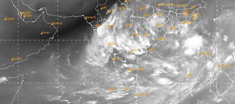

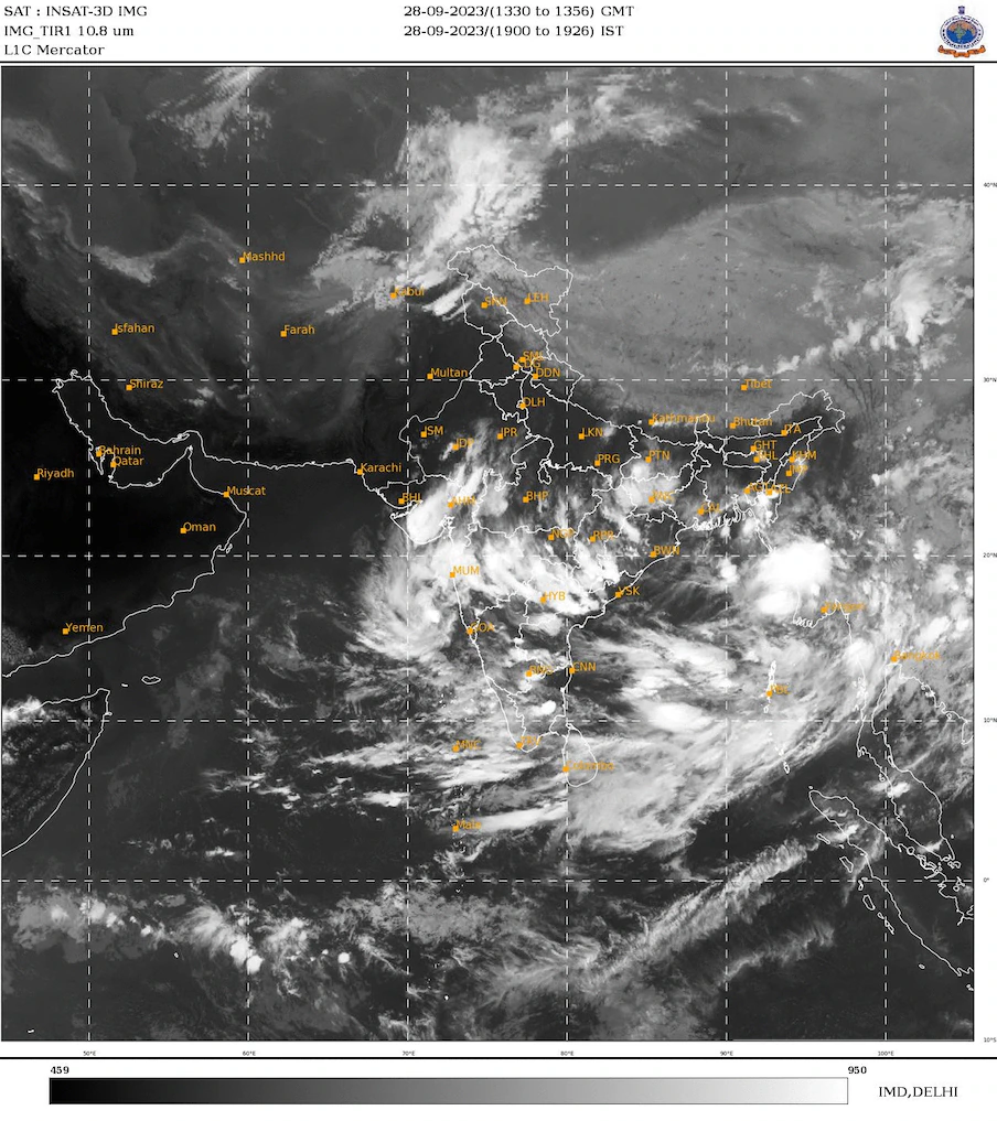 The low pressure system that formed on friday over the northwest Bay of bengal, together with a cyclonic circulation that extended up to 7.6 km above mean sea level, was blamed for the current weather conditions. Within the following 24 hours, it is predicted to travel across north odisha and neighbouring West bengal in a west-northwesterly direction.
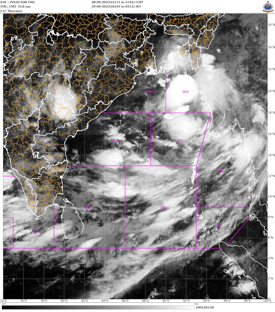 Meanwhile, despite the late onset, telangana recorded a normal monsoon this year. The cumulative rainfall of the state at the end of southwest monsoon (June 1 - september 30) is 861.1 mm against normal 738.6 mm with 17% deviation. According to telangana State Development Planning Society, this is the fifth consecutive year where southwest monsoon has shown above normal rainfall with 2019 recording 10% deviation, 2020 (50%), 2021 (40%) and 2022 with 39%
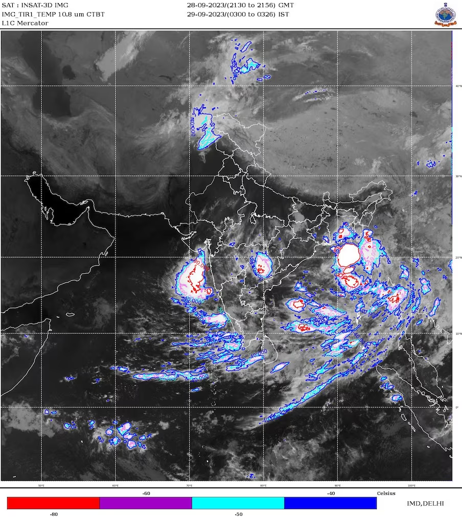
 click and follow Indiaherald WhatsApp channel