

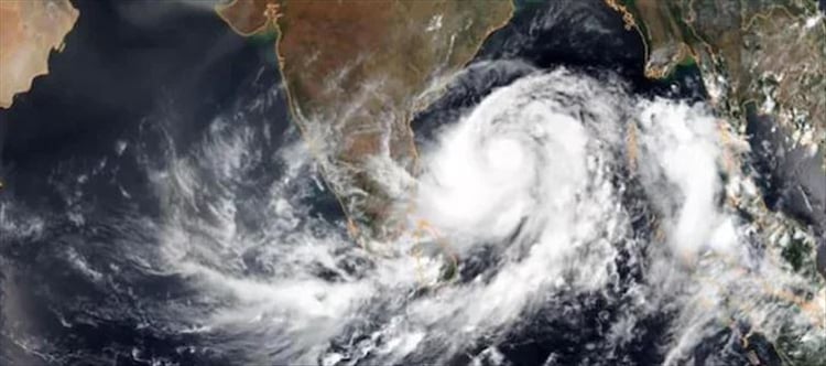

By december 8 am, the low-pressure region that has developed over the southern andaman Sea is highly likely to become a cyclonic storm and approach the southwest Bay of bengal around northern tamil Nadu, Puducherry, and the nearby south andhra pradesh coast. At 5.30 am on Monday, a low-pressure region developed over the south andaman Sea as a result of the cyclonic circulation over that area and the adjacent equatorial indian Ocean-Strait of Malacca.
The associated cyclonic circulation reaches the middle of the troposphere. By december 6 evening, it is forecast to travel west-northwestward and consolidate into a depression over the Southeast Bay of Bengal. On december 5, a low-pressure region is expected to form over the southeast Bay of bengal and the nearby South andaman Sea, according to the indian Meteorological Department (IMD). By the morning of december 7, the low-pressure system could move west-northwestward and consolidate into a depression over the Southeast Bay of Bengal.
Beginning on the evening of december 7, the weather system may bring rain to seven districts of tamil Nadu, Puducherry, Karaikal, and the southern coast of Andhra Pradesh. The rain is anticipated to get heavier the following day. From december 4 to 6, widespread light to moderate rain is also anticipated throughout the andaman and Nicobar islands. Until december 8, the IMD urged fishermen to stay away from the Bay of bengal and the andaman Sea. The coastlines of tamil Nadu, Puducherry, south andhra pradesh, and the gulf of Mannar should also be avoided from december 7 to december 9.
