

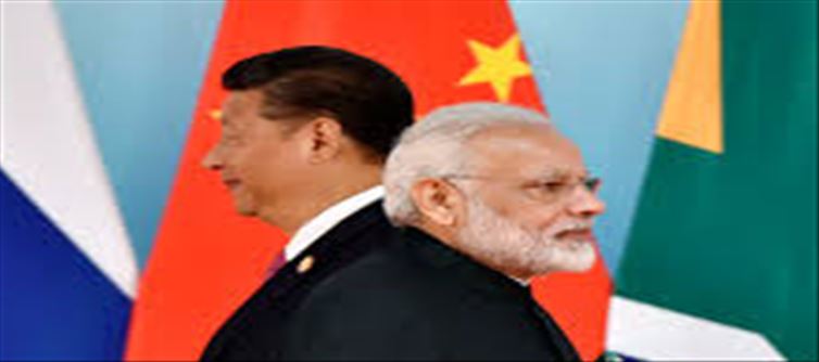

china has once again released a new map while doing provocative work, in which India’s Arunachal Pradesh and
Aksai Chin have been shown as their share. This map has been released at a time when the Chinese President is
going to come to New delhi for the G-20 meeting to be held in september next month. congress MP Manish
Tiwari has called this map absurd. Along with this, he has also given advice to the Central Government.
Speaking to news agency, Tiwari said, "China's claim is absurd and its futility is proved by the history of the Sino-
india border dispute." The real issue today is that china has violated LAC at several points at the theater level. In
such a situation, the government should seriously introspect whether it would be in accordance with India's self-
respect to call such a person Xi jinping in delhi, who has illegally occupied 2000 square kilometers of Indian
territory adjacent to LAC.
What did manish Tiwari say on the new map of China?
On the new map of china, manish Tiwari said, there are three sectors of the India-China border. One is the eastern
sector, where the McMahon Line has been recognized as the border between india and china since 1940, when
representatives of india, china and tibet signed a treaty. As far as the middle sector is concerned, there is no
dispute between the two sides except some minor issues. The real problem is on the western sector, where the
border is not properly delineated. In 1865, the british government tried to delineate this area for the first time. He
conducted a survey to determine the boundary between the state of kashmir - SRINAGAR/JAMMU' target='_blank' title='jammu and kashmir-Latest Updates, Photos, Videos are a click away, CLICK NOW'>jammu and kashmir and Tibet. A boundary
was proposed, called the Johnson-Ardeg Line.
 click and follow Indiaherald WhatsApp channel