


New Delhi, India: The NASA-ISRO Synthetic Aperture Radar (NISAR) satellite, a joint venture between nasa and the indian space research organisation (ISRO), is proving to be a game-changer in understanding soil moisture levels across India. By providing highly detailed and consistent measurements, the satellite data is assisting scientists and authorities in monitoring the country’s land and water resources more accurately, contributing to agriculture, disaster management, and climate resilience.
What is NISAR?
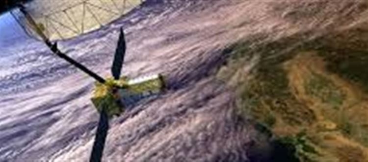
NISAR is a cutting-edge Earth observation satellite equipped with a Synthetic Aperture Radar (SAR), capable of producing high-resolution images. The satellite is designed to collect data on a variety of environmental and climatic factors, from ice sheet dynamics and volcanic activity to soil moisture, agricultural conditions, and deforestation.
Launched with a mission to observe and map Earth's surface, NISAR’s ability to measure soil moisture is one of the most important applications for agriculture in india, where soil moisture plays a critical role in crop production and water management.
Measuring Soil Moisture: The Importance for India
Soil moisture is one of the most crucial factors influencing crop growth, water availability, and overall agricultural productivity. For a country like india, which relies heavily on agriculture, understanding the variations in soil moisture across its vast landmass is essential to optimize irrigation practices, mitigate drought risks, and prevent crop failures.
· Drought Management: By accurately tracking soil moisture levels, NISAR data helps predict the onset and severity of droughts, allowing farmers and policy-makers to take preventive measures before significant damage occurs.
· Improved Irrigation: The satellite’s data enables more efficient water use by helping authorities identify areas where water conservation efforts are most needed and where irrigation systems can be optimized.
· Agricultural Planning: By offering real-time insights into soil moisture levels across the country, NISAR aids in crop planning and yield prediction, allowing for better planning of food production and distribution.
How NISAR Measures Soil Moisture
NISAR uses microwave radar signals that can penetrate the ground surface, capturing data on the amount of water in the soil. Unlike optical or infrared-based satellites, which rely on visible light, radar satellites like NISAR can operate day or night and under any weather conditions, providing consistent and reliable measurements.
The data collected is then processed and used to generate soil moisture maps, which offer an in-depth view of moisture levels across different regions. This capability is especially valuable in regions prone to weather extremes such as floods or droughts, providing timely and actionable insights.
NISAR's Role in India’s Agriculture and Water Management
India’s agricultural landscape spans different regions, each with unique challenges in water management and crop production. The NISAR satellite’s ability to cover the entire indian landmass allows for a holistic view of the country's soil moisture, helping authorities make data-driven decisions at the local, regional, and national levels.
Supporting National and State-level Planning
The data from NISAR is also being used to support the government’s national initiatives like the National Mission for Sustainable Agriculture and Pradhan Mantri Krishi Sinchayee Yojana (PMKSY), which aim to improve the efficiency of irrigation systems and promote sustainable farming practices. The satellite’s monitoring capabilities help ensure that resources are distributed where they are most needed, reducing wastage and improving agricultural output.
Enabling Early Warning Systems
In addition to soil moisture, NISAR’s radar can also measure flooding and other weather-related events, providing early warning signals that enable local authorities to respond quickly. This capability is vital for improving disaster preparedness and managing the impact of extreme weather events, which are becoming more frequent due to climate change.
Future Prospects and Global Impact
India’s integration of NISAR into its environmental and agricultural monitoring framework is just the beginning. The satellite is set to continue gathering critical data on a range of climate and environmental factors, helping both India and global communities prepare for future challenges related to climate change, food security, and water conservation.
As NISAR continues its mission, the insights gained from its observations will provide actionable intelligence that can inform policy-making, disaster response, and sustainable land management for years to come.
Conclusion: Empowering India’s Future with Satellite Data
NISAR’s soil moisture data is revolutionizing India’s approach to agricultural planning and water management. By combining satellite technology with actionable data, india is better equipped to face the challenges posed by climate change, resource scarcity, and agricultural inefficiencies. As the satellite continues to monitor the nation’s environmental conditions, it plays a vital role in shaping a sustainable and resilient future for indian agriculture.
Disclaimer:
The views and opinions expressed in this article are those of the author and do not necessarily reflect the official policy or position of any agency, organization, employer, or company. All information provided is for general informational purposes only. While every effort has been made to ensure accuracy, we make no representations or warranties of any kind, express or implied, about the completeness, reliability, or suitability of the information contained herein. Readers are advised to verify facts and seek professional advice where necessary. Any reliance placed on such information is strictly at the reader’s own risk.
 click and follow Indiaherald WhatsApp channel