

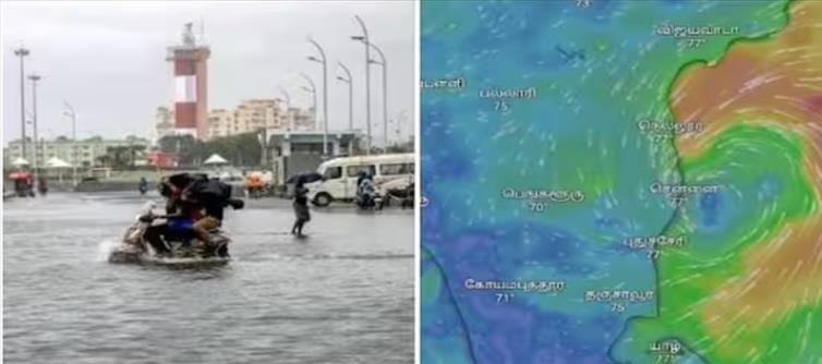

The Meteorological Department informed that the storm which will form in the Bay of bengal will cross the coast between chennai and Masulipatnam on the 4th. Northeast Monsoon has intensified. Due to this, rain is falling in various parts of tamil Nadu. In this situation, the low-pressure area formed in the Bay of bengal has strengthened as an extreme low-pressure area and has now intensified into a low-pressure zone. It will move further in the West-Northwest direction and may intensify into a storm over the Southwest Bay of bengal by 03-12-2023. After that, it is reported that it will move in the northwest direction and may prevail over North-East-South Andhra coastal areas in the morning of 04-12-2023.
 According to the Meteorological Department, the storm formed in the Bay of bengal is expected to cross the coast on the 4th.
When will the storm make landfall?
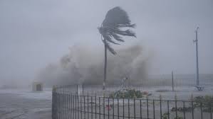
Due to this storm, a wind speed of 60 to 70 km per hour is likely to blow in the Southwest Bay of bengal and adjoining Central West Bay of bengal, according to the Meteorological Department. Following this, fishermen have been denied permission to go fishing. Precautionary measures are also being taken to face the storm. The storm that formed in the Bay of bengal on the 3rd will be named Mirjam.
 Meanwhile, this storm will make landfall between Masulipatnam and chennai on the evening of december 4, according to the Meteorological Department. A warning has also been issued that there is a possibility of heavy rain with wind in chennai and surrounding districts when the storm crosses the coast.
 click and follow Indiaherald WhatsApp channel